Zoom Zoom and I stopped here to view this natural wonder. First off, we pulled up to the new structure where we paid our fee to enter the area. The parking went seamlessly. The volunteer that took our fee told us exactly where to park. He also told us dogs were allowed on the trail. We decided Abby needed a break from the RV. BIG mistake. No matter how much water we carry, she will not drink on a hike. Also, the trial is paved! Great for people, but terrible for paws since the temperatures can get quite high! I ended up carrying her until we got to the observation point and then carried her back to the RV.
The “bend” in the canyon was created by the Colorado River as it made its way to the sea. Around 5 million years ago the Colorado Plateau uplifted leaving rivers that meandered across the landscape trapped! Of course trapped water takes the path of least resistance during rainfall and so the river carved its way through the sandstone escarpment. Looking over the rim, it drops a mere 1,000 feet to the river! The Glen Recreation Area, with the other surrounding parks, cities and Navajo Nation have made changes to the area to make the trail to the bend ADA compliant. The trail is 1.5 miles round-trip on a completely flat surface. Two structures for shade have been erected and a viewing area complete with a railing opened January 2020. As always, if you are going to take this little hike, BRING WATER and wear the proper foot gear! Sunblock is a good idea too, since this wonder is located in the desert!
Abby hates to have her picture taken!
Once Zoom Zoom and I got to the rim, we were simply astonished by the beauty of the bend. The color of the water is an emerald green. I thought people had been throwing trash over the rim because I saw these tiny little “bottles.” Then I thought, oh, those are tiny little paper boats that kids made and threw over! Nope! The tiny floating objects were kayaks! You can kayak down the river here. There is company that drops you off 10 miles up river and picks you up at a designated spot! We are adding this to our “Bucket List.”
The dots are kayaks.
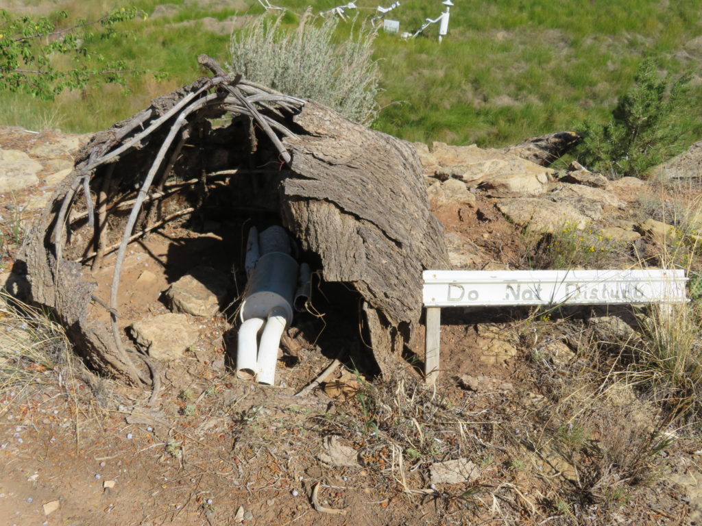
Porta-potties.
After viewing the bend, we headed back to the RV. The brochure says the path is all a flat surface, it is. What the brochure doesn’t say is it is all downhill to the bend along a flat surface and uphill back to the parking lot. The temperature the day we were there was right around 97 degrees – of course it was a “dry heat.” We needed our water for sure!
If you are as old as Zoom Zoom and me, you recognize this theme song. As we were traveling to Camp Verde, AZ along US – 180 from the Grand Canyon, we glimpsed a gigantic Fred Flintstone on the horizon. This theme park opened in 1972. The original owner licensed the likenesses of the Flintstone characters. They built statues, houses, cars, dinosaurs, and rides all based on the original cartoon. January 2019 the park closed. It reopened mid-June 2019 with a new name – Raptor Ranch. The new owners are redoing the original Flintstone park and are adding a raptor show. They have falcons and an owl named Stinky. To view the Flintstone park part, it costs $5.00 per person. Even though it is a little worn – it is still worth a stop!
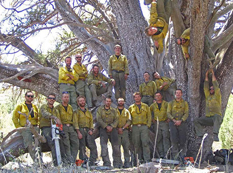
Let me begin by saying, “Thank you.” I want to let these men know we appreciate them. These men put their lives on the line everyday and on June 30,2013, these 19 men lost their lives fighting a wildfire sparked by lightning on Bureau of Land Management lands near Yarnell, AZ.
THANK YOU…
*Andrew Ashcraft, 29
*Anthony Rose, 23
*Christopher MacKenzie, 30
*Clayton Whitted, 28
*Dustin Deford, 24
*Eric Marsh, 43
*Garret Zuppiger, 27
*Grant McKee, 21
*Jesse Steed, 36
*Joe Thurston, 32
*John Percin, 24
*Kevin Woyjeck, 21
*Robert Caldwell, 23
*Scott Norris, 28
*Sean Misner, 26
*Travis Carter, 31
*Travis Turbyfill, 27
*Wade Parker, 22
*William Warneke, 25
June 30,2013 these 19 men were trapped by the fast moving fire. They deployed their fire shelters when they became surrounded by the fire. Heat from the fire soared over 2,000 degrees.
The Blue Ridge Hotshots were on site too. They attempted to rescue the men, but were unable to because of the intense flames and heat from the fire. The next morning it was these men that discovered the Granite Mountain Hotshots remains.
If you visit the memorial, there is a bronze figure of a firefighter with a bench and there is a memorial board explaining the day. If you want to hike to the actual site there is about a 3 mile hike to an observation deck and another 3-4 mile hike to the actual site. Bring plenty of tissues and water.
These next images I took from the Hotshots website…
If you want to know more about the Hotshots, a movie was made based on this story. It is called “Only the Brave.”
Thank you to all our Firefighters and First Responders!
Zoom Zoom and I were fortunate enough to spend 3 days in the canyon. One of our questions about the park was: how long is the Grand Canyon? Looking it up on one of many informational sites located at the canyon – we got our answer! It is 277 miles long, about 18 miles wide and a mile deep! Of course it isn’t finished growing. The weather is the biggest factor in changing the canyon. Rain, snow and wind change the canyon on a daily basis.
Only YOU can prevent forest fires!
We spent the first day exploring the village which is also called the Grand Canyon Village Historic District. The village encompasses 8 buildings. Back in September of 1901, the very first steam powered train arrived from Williams, AZ to the South Rim of the Grand Canyon. Over the next 10 years the 8 buildings were built and the “Village” became a bustling place.
We were able to see all the places, but the Kolb Studio and Bucky O’Neil’s places were closed.
The Santa Fe Railway Station is up and operating! They have 4 different “car” experiences from $33.50 – $113.00 each way for an adult ticket. It is a 54.4 mile trip to Williams, AZ. I think going during the winter would be a great time to go! It will look like a Winter Wonderland.
The El Tovar Hotel is just up the hill from the train station. It looks like a Swiss Chalet! It was completed in 1905. In 1905, this hotel was considered to be the most luxurious hotels west of the Mississippi.
The Hopi House is just across the courtyard from El Tovar Hotel. It was designed by the famed architect, Mary Colter. The Hopi House was her first work and it opened on New Year’s Day 1905. She used building from an ancient village near the Hopi Reservation for inspiration. The doors a low, the ceilings are thatched, and the “bricks” are molded from res sandstone. The building is a 2 story gift shop and cultural center.
Vercamp’s Visitor Center began as Vercamp’s Curios in a tent in 1898! When Vercamp first arrived at the Grand Canyon to set up business he didn’t stay long. There wasn’t enough business. After the train station was up and running he decided to return to build a shop. He opened this shop in 1906. In 2008, the National Parks Service purchased the building. It is now a visitor center, museum, and store.
Lookout Studio was IMPRESSIVE! It was built on the edge of The Rim. This building was also designed by Mary Colter. There are 2 porches that face the canyon. It seems as if this building is suspended in space!
The next day, Zoom Zoom and I hiked “parts” of The Rim. The park has a shuttle system that runs from The Village to Hermits Rest. It has several stops along the way where we were able to get off at the points of interest and get on the next bus. We went all the way to Hermits Rest, look around and came back to Mojave Point to hike back to The Village. It is about 4.5 miles back. When it is advertised that you walk The Rim, you really do. Several sections have no railing nor rocks to outline the route. Before you venture out they warn you to stay 6 feet from the edge! I can tell why! The next set of phots aren’t in any order. Once you see the Grand Canyon it all starts looking the same.
Our “before” photo.
9-11
Part of the Bright Angel Trail.
Horses are for an overnight ride to the bottom of the canyon.
Watchman Tower
Colorado River
COVID-19 is keeping the crowds away!
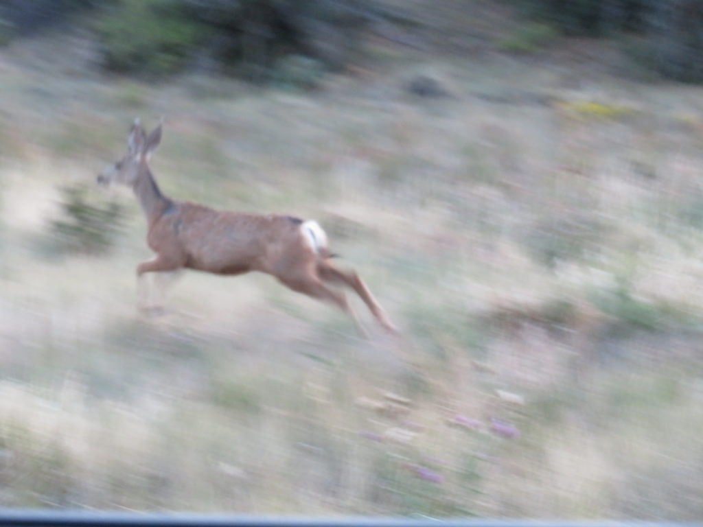
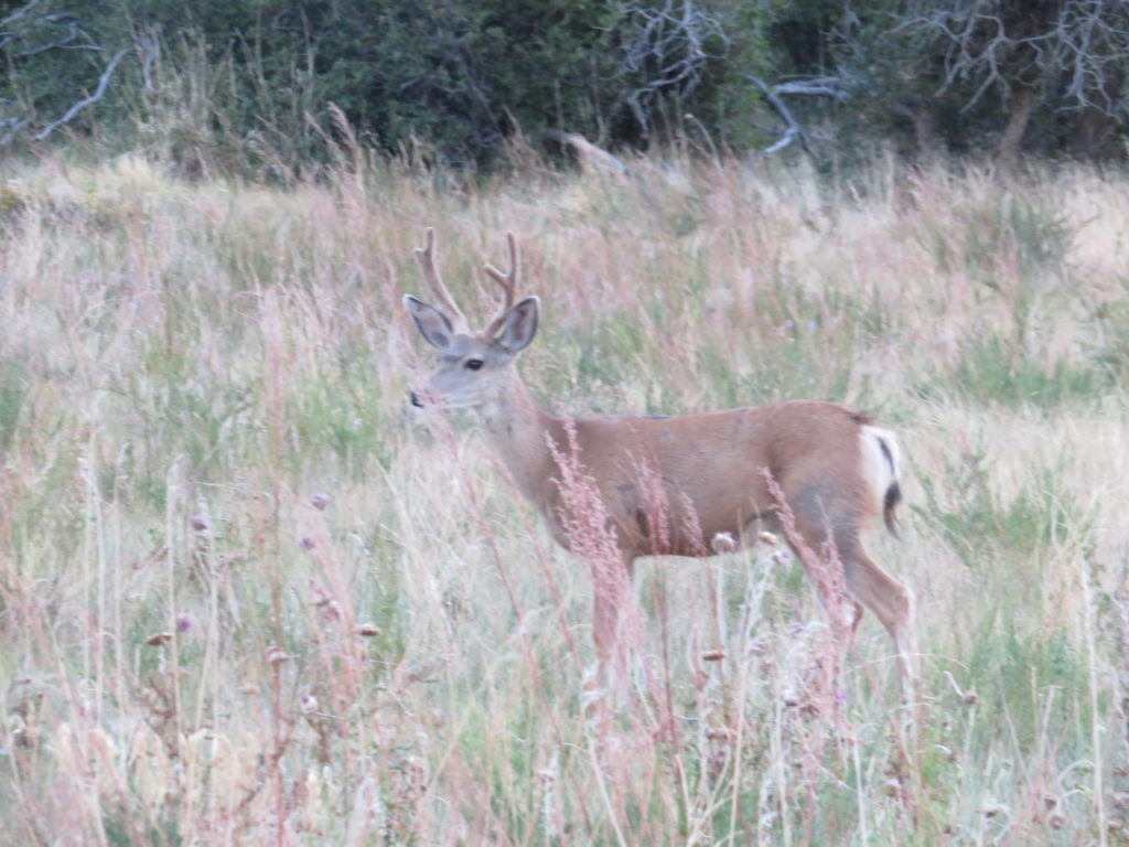
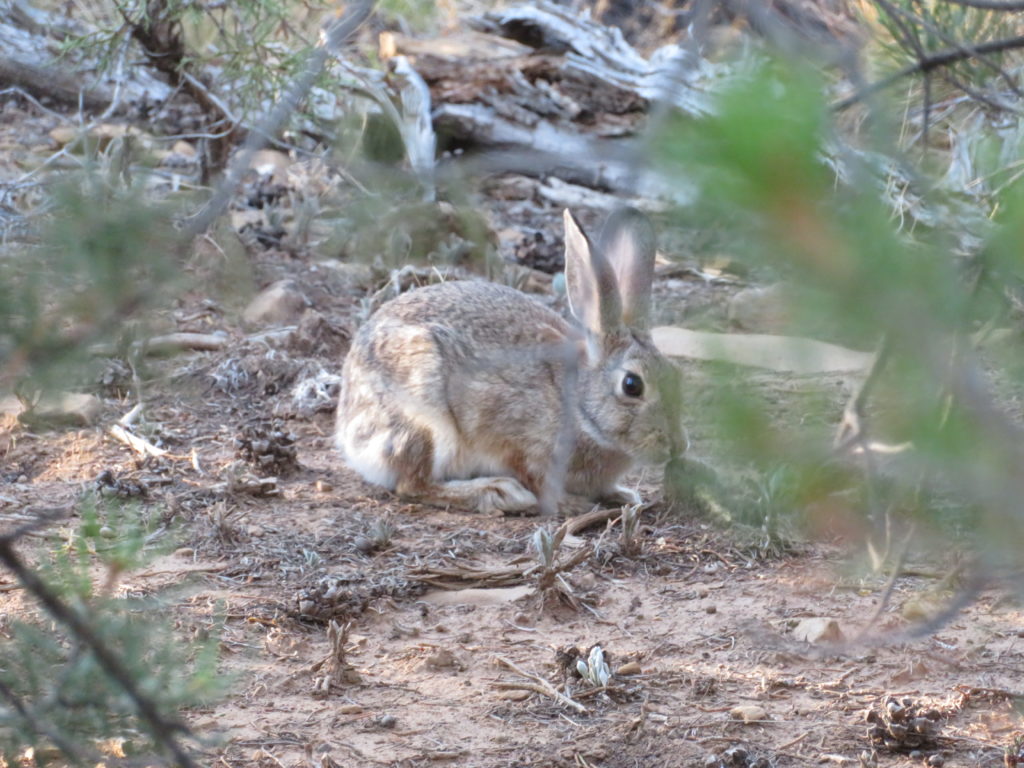
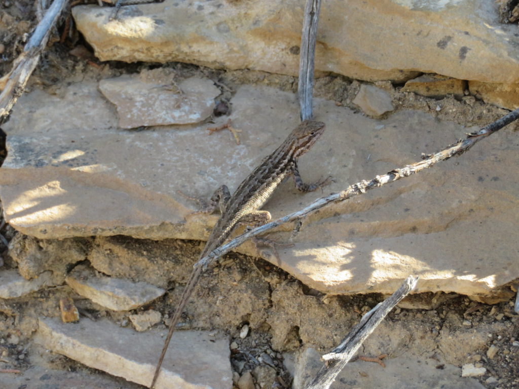
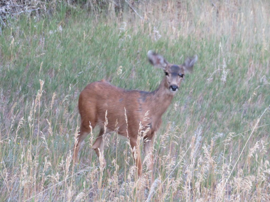
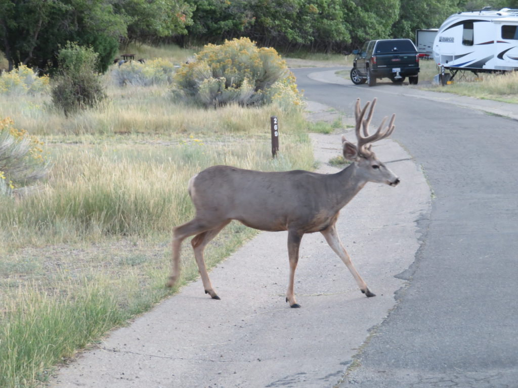
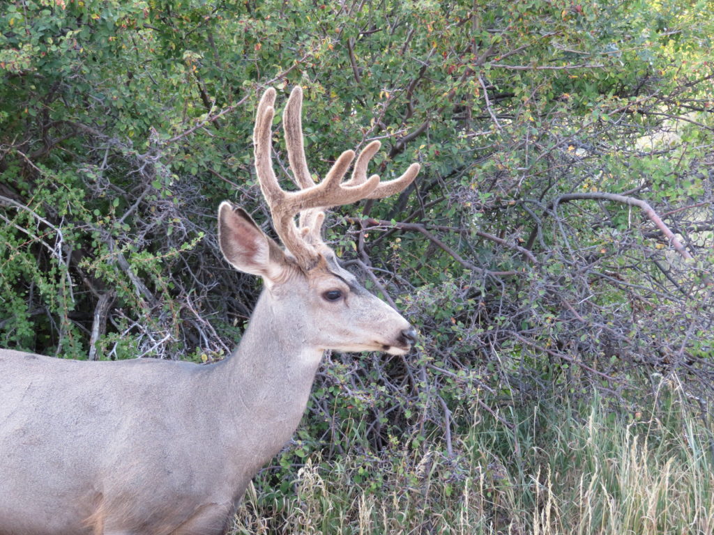
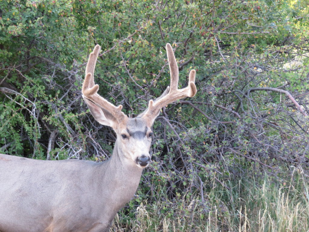
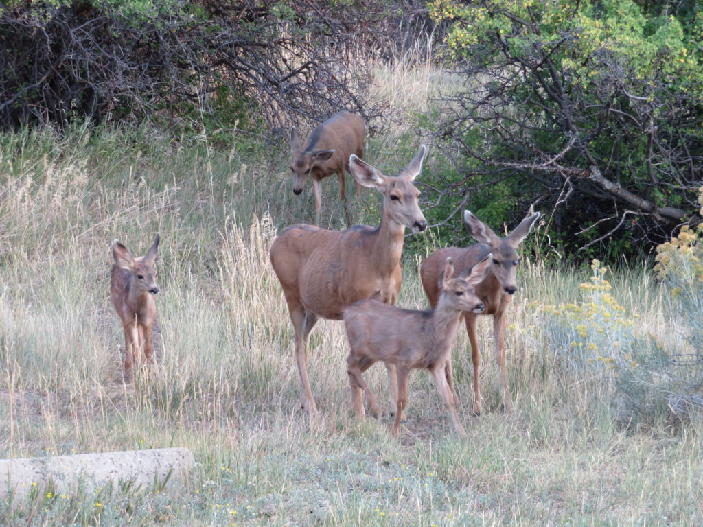
Animals spotted in the park…
Ravens that can read!
We saw a bunch of lizards on every hike. We thought they were good luck for us!
Turkey vultures.
Skinny Gus!
Mamma Elk.
Peek-a-boo!
We also spotted several idiots not heeding the warnings! These idiots crossed every barrier they could for the “perfect” photo!
What an amazing park. We entered through the Zion Tunnel. This tunnel was built in the 1920’s. Back then larger vehicles weren’t common. Because we were in an RV and hauling a vehicle, park rangers on either end of the tunnel control traffic. If we were only driving Jethro driving through, the tunnel is free, but if they have to control the traffic for you it costs $15.00 for 2 tunnel pass throughs that need to be used within 7 days. The oncoming traffic was stopped at the other end so we could drive down the center of the tunnel. The tunnel itself is 1.1 miles long. When we exited the tunnel there were several switchbacks. I got a little car sick from all the back and forth. Once we got into the park we set up camp for one night. The reservation schedule is tight so we had to move sites the next day.
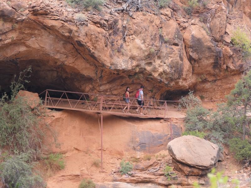
Our first hike we took is called the Canyon Overlook. This trail is 1 mile long in and out and rated “Moderate.” The first part seemed like it went straight up some naturally made stairs with a rail to hold on to. The thing I forgot about Utah is it is like landlocked beach. As we hiked it is a little slippery from all the sand. We really enjoyed this hike because it had a lot of boulders to climb over and places where we needed handrails so we wouldn’t slip off the side of the mountain. One section hangs out over the canyon as you go around the edge of the mountain. The park service installed a wooden bridge to use to get around the side of the mountain. They placed 3 planks, side-by-side to create the width of the bridge. They left some space between the boards so you can see straight down! If you are scared of heights, like I am, this is an easy bridge to conquer! I just looked forward and told my feet to just move on. Zoom Zoom seems as if he isn’t afraid of anything! Once we got to the overlook it was beautiful in spite of all the smoke from the California fires. The topography is amazingly stunning. The way the mountains jut out of the ground to form different peeks blows my mind.
Before the hike…
Up at the Overlook…
After the hike…
Beginning of the trail.
Cheese!
Narrow trails.
Steep drop-offs…
Channeling my inner GGPA!
Canyon view…
Narrow trail.
The second day in the park we hiked the Watchmen Trail. This trail was rated moderate. We had several switchbacks, narrow areas, boulders to climb over and on, and it had a pretty good grade on the way up. Stopping for breathers was a must for this Honey since breathing through our masks was somewhat difficult. Once we arrived at the top – wowza– the view was so pretty!
Before the hike…
Ignore the underlining!! UGH!
Pillsbury Dough Biscuit rock!
Faking it!
Zoom Zoom liked the boulders…
The Watchman. It’s hazy because of the California fires!
The third day we were in the park we were able to check off several hikes. We caught the shuttle and headed further in the canyon. We did the Lower Emerald Pool, Middle Emerald Pool, Upper Emerald Pool, Kayenta Trail, the Grotto Trail AND the Riverside walk! All of these trails are rated easy and moderate.
We followed this family on Riverside Walk. The oldest son was saying the best part of the hike is when it is over! The little son just followed along and the middle son – he was NOT happy about being in nature! I thought for sure he was going to fall in the water. Here they are entering the Narrows.
Fat Gus wants a snack!
All the squirrels along the Riverside Walk were fat. They were not afraid to beg for food!
Please, sir, could you spare a nut!
The fourth day at the park we headed over to Kolob Canyon, Zion’s sister park. This park is is the same system as Zion, it is just not as heavily trafficked! We did an easy trail called the Timber Creek Overlook Trail. The views are so pretty. We got to see a hanging valley, an several layers of the earth’s crust!
One of the hanging valleys.
Fat Gus’ cousin, Fat Gus! We named all the squirrels Fat Gus!
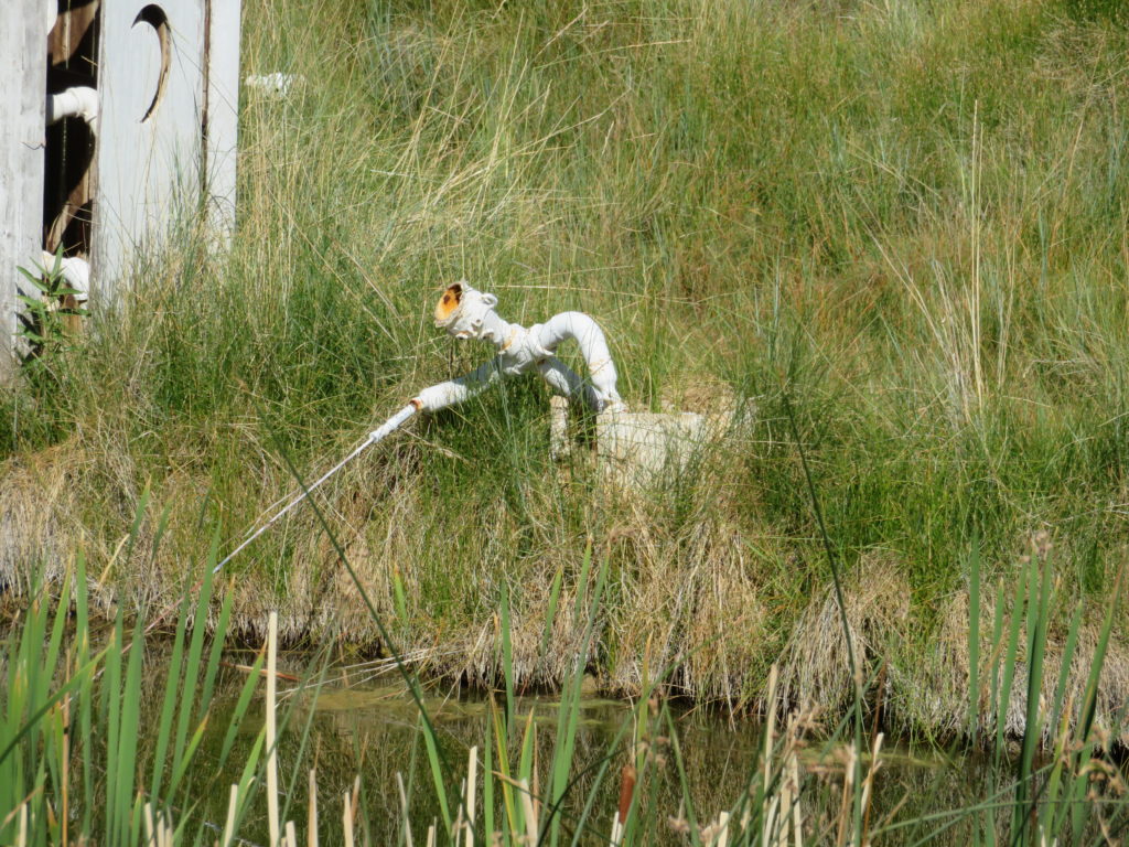
I’m going to say it now, “We enjoy the Roadside America App.” This place in Mancos, CO was another attraction found on the App. We were fortunate enough to be greeted by the owners/artists of this place. Their names are Nancy and Dave. Dave does all the carving and creating , while Nancy does all the finish work – the painting and staining. Zoom Zoom fell in love with one of their pieces-a tree with 4 bears in it. Dave told Jeff the price ( $$$$ ) and we decided on some other art or he could travel with the piece and I’d need a flight home! After a long arduous decision, I bought a raccoon, 3 fish and a bird! I asked Dave if he would take a photo with Zoom Zoom and some of the pieces we bought so we would always remember him. He agreed! If you like folk art or just quirky art – stop here! Dave and Nancy are always open, unless they aren’t home!
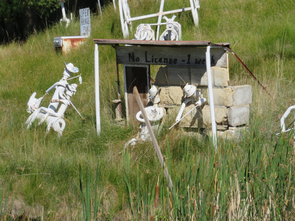
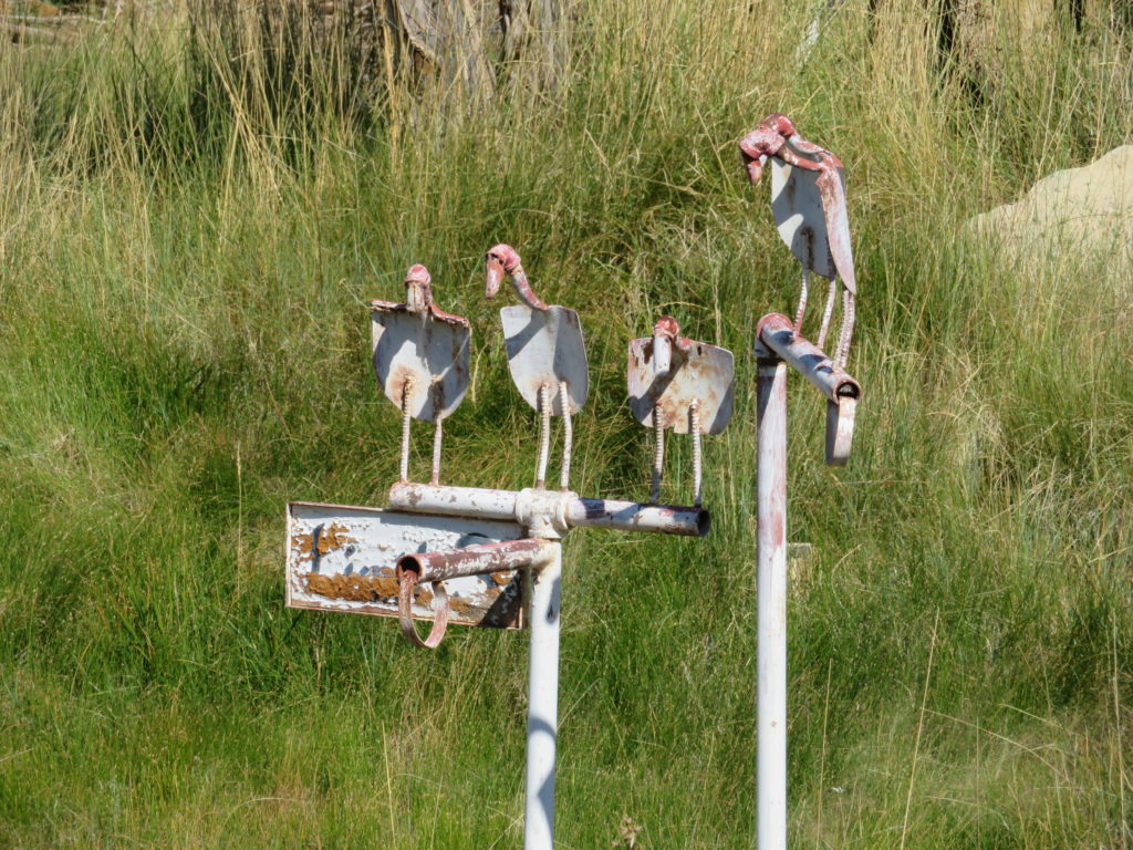
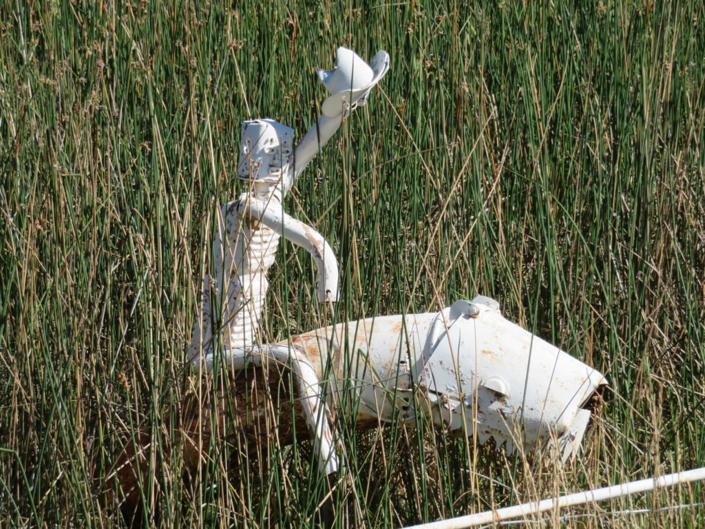
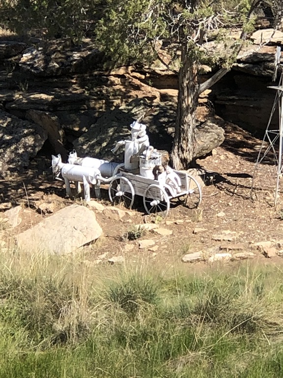
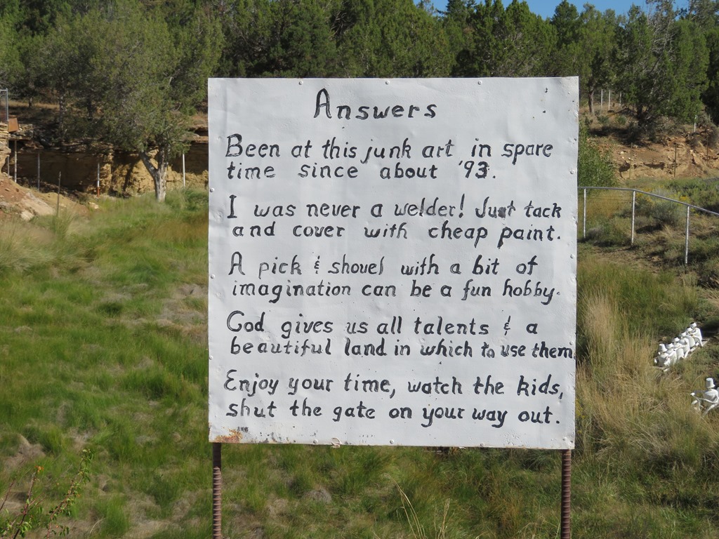
Using the Roadside America App, we found a man that uses mostly scrap mufflers to create art. He has turned his front yard into an art exhibit. It’s amazing how creative people are! Just a fun place to stop.
*Driving tip – His place is just over the top of a hill – be prepared. Also, there is limited parking right in front of his place. I’m sure his neighbors love him!
I love that he posted this.
Wagons Ho!
The dad has a sign that says, “SAFETY.”
When I lived in Taiwan this was a common sight.
Everybody Poo’s!
These guys are on their way to AREA 51.
Weeeeeeeeee!
Swing your partner to and fro’.
Just another day on the ranch.
Alien invasion!
Another use for Solo Cups! She had a cup job recently. 🙂
Mesa Verde National Park is also a part of the World Heritage Museums. When I usually think of parks I just think of lakes and hiking. This park is part (no lakes) of that and more. There are some hiking trails, but because of COVID most trails are closed. More importantly than the trails is the history here. This is where the Ancestral Pueblo people lived for over 700 years! I know there are a lot of places where the people have lived in a particular place for longer, but these people did it differently and to think – with no modern tools. Most of the Ancient Pueblo people lived communally. They worked together and built structures with several rooms – think old school apartments. The Ancestral Pueblo people first lived on top of the mesa and then moved to the crevices on the sides of cliffs! No one knows exactly why the Ancient Pueblo people chose to move off the mesa to the cliffs. Speculation would be, they chose to move for safety and if the canyon was filled with water, this put them closer to the source. Archaeologists found at least 600 of these cliff dwellings and some 4,300 artifacts as they have been researching this area. Some dwellings were clustered together and some were spread out. They also found a place that was probably like the town square. The artifacts found there helped develop this theory. After witnessing this place in real life, I just don’t know how they did it. To get to their homes they had to scramble down ladders or use ropes made of yucca woven together. At one of the sites they found a woven rope 1,350 feet long! Looking at the dwellings there defiantly was growth in their living over the 700 years.
Take 1…
Take 2…
Take 3!
The first Ancient Pueblo people lived in Pithouses. These are houses they built in the ground. They entered the house through the roof.
These circular structures are called Kiva’s. These were sacred rooms for ceremonies or tribe meetings. The Kiva would only be entered by the men in the tribe.
Look closely just below the top of the mesa. There is a carved out area (arch) that resembles a rainbow shape. One of the dwellings can be found here.
The Square Tower got its’ name for obvious reasons. It is difficult to see how moving to these kinds of dwellings was better than living on top of the mesa. Several families would occupy this dwelling. Look for the circular structure again – that is the ceremonial place – another sacred place.
Designated driver!
Before moving to the cliffs, the Ancient Pueblo people lived on the top of the mesa. The archaeologists found 3 different communities built on this site – one on top of the other. They were farmers. They planted corn, beans, and squash. These 3 things were all they needed to survive if they couldn’t find anything else to eat. They also hunted rabbit, deer and other animals.
Can you see the door that leads back to the main house. These people were TINY!
The square opening here is for ventilation. They would light their fire in the center and hold their ceremonies around the fire.
Close-up of a doorway.
This is one of the cliff dwellings found. Can you imagine if it was your turn to walk the dog???
This dwelling is a larger community. Several families and generations would live together. The other thing to think about is the canyon was probably full of water back then. You can see this by the layers on the side of the canyon.
Look closely at this photo, you can see that this dwelling is “double” layered.
Looking at the center top, it looks like an arch. The New Fire Temple and New Fire House are located here.
When you think of the cliff dwellings, it’s the Cliff Palace that comes to mind. When purchasing a souvenir, the companies use the Cliff Palace photo as their dwelling photo of choice. This place was akin to our town squares. There are at least 150 rooms. Several foot paths lead to this place. The archaeologist think this place was like our government offices like today. This is the place where no “home” artifacts were found. Of course it is just speculation. The cliff dwellings that the archaeologists are certain were homes had their “trash” thrown down the cliff side. They found bones, bowels, utensils and a lot more. It’s funny to think they were the original litterers, but if they hadn’t littered we would have an even lesser understanding of them.
Like the Cliff Palace, the Sun Temple seems to be a place of gathering for the surrounding villages.
COVID-19 pose.
Sunday morning Zoom Zoom and I tried to hike the Petroglyph Point Trail. Unfortunately, the trail wasn’t fully open. We did have a good hike though and made the best of it. We had spectacular views of the canyon.
Trying to show the drop-off to the dwellings.Standing right by the drop off.
These next 3 photos are of the same dwelling. There are no other dwellings near this one. I was using my binoculars and just scoping out the canyon, noticed the boulder that looks like a pot with a lid and I just kept looking and saw the dwelling. It still baffles me as to how they were able to live here!
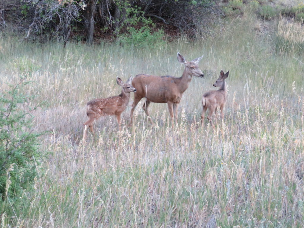
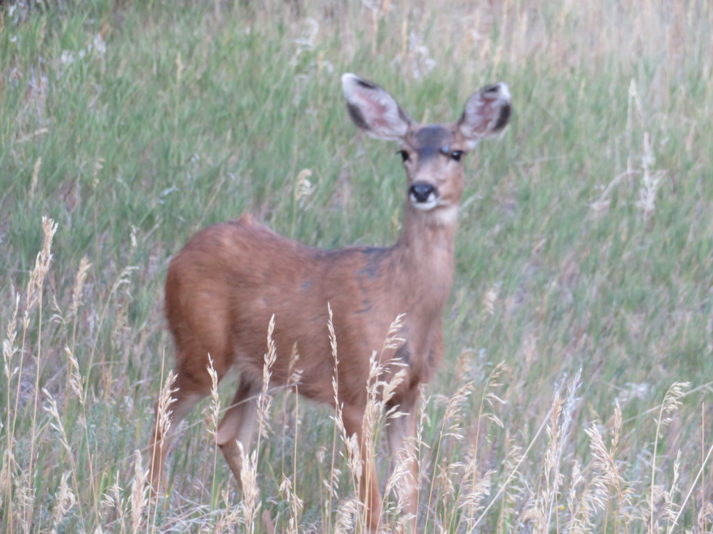
As we toured the park, we were fortunate to see several different kinds of wildlife. From mule deer to wild horses!
As we travel around, we are fortunate to stay overnight in some amazing places. We are members of Harvest Hosts. It gives its’ members free overnight dry camping at several kinds of businesses all over the country. Tonight we are sleeping with some alpacas. We are staying at Pleasant Journey Alpacas. All Zoom Zoom did was call the day before to be sure they have space and are accepting company! We were met by one of the owners, Susan Kacsh, and she directed us where to park and waited for us to give us a personal tour! They have almost 100 alpaca on the property. She and her husband, Glenn, have been raising these cuties for around 13 years. Not only do they breed and show their alpacas, but they also board other owners’ alpacas. It is a beautiful operation. Susan explained that these critters don’t take much upkeep on a daily basis. Couple of hours each morning is all, unless it is breeding time or sheering time. The alpaca get sheered once a year. Probably one of the most amazing things is Susan knows ALL the cuties names. They had 3 babies born Monday. One they named Mr. Wesson and another they named Mr. Smith. They have an Abby, Miracle and even a Clancy! Susan makes alpaca yarn for their shop and Glenn makes beautiful yarn bowls and other woodworking art. They sell other alpaca related items in the store too. If you go to their website it will connect you to the store. Here is a tidbit Susan also shared with us…they are ready to retire! They are going to sell the entire 35 acres: all barns, equipment, the house, and of course their alpacas! Just give them a call and they will give you a tour (and training!)
Management office and store.
Greeter.
Greeter.
Abby, head greeter.
Head of Security. It carries a BIG bark and an even BIGGER bite! If I remember correctly this breed is called a Maremmaso. The Kacsh’s own 3 of these dogs.
Second in Command.
Third in Command. I like cuddles.
Our campsite – great view of the alpacas!
Do chocolate alpacas give chocolate milk?
Sitting pretty!
Zoom Zoom is a chick magnet!
Susan Kacsh, owner. This little one was born Monday.
Zoom Zoom and his women!
Wait, mom, I’m not finished yet!
Cheese!
Nap time!
Boys trying to be boys.
Pumpkin snack.
The ranch is surrounded by groundhogs. Great for us, not so much for all the land owners.
Thank you Susan and Glenn we had a great stay here.
Random alpaca facts…(or not)
1. OMG, so cute! (That’s a FACT!)
2. They pee and poop in a communal dung pile. Easier to clean up!
3. Sometimes they spit at you if they don’t like your outfit! (That’s a FACT!)
4. Alpacas can live up to 20 years.
5. Alpacas come in two breeds-Huacaya and Suri. Susan and Glenn own all Huacaya. They board Suri for a client.
6. In the winter, alpacas prefer to wear alpaca socks on their feet. (That’s a FACT!)
7. They weigh between 110-190 when they are full grown.
8 . Alpacas don’t have teeth in the top-front of their mouths. This gives them the appearance of having an underbite. (No braces needed)
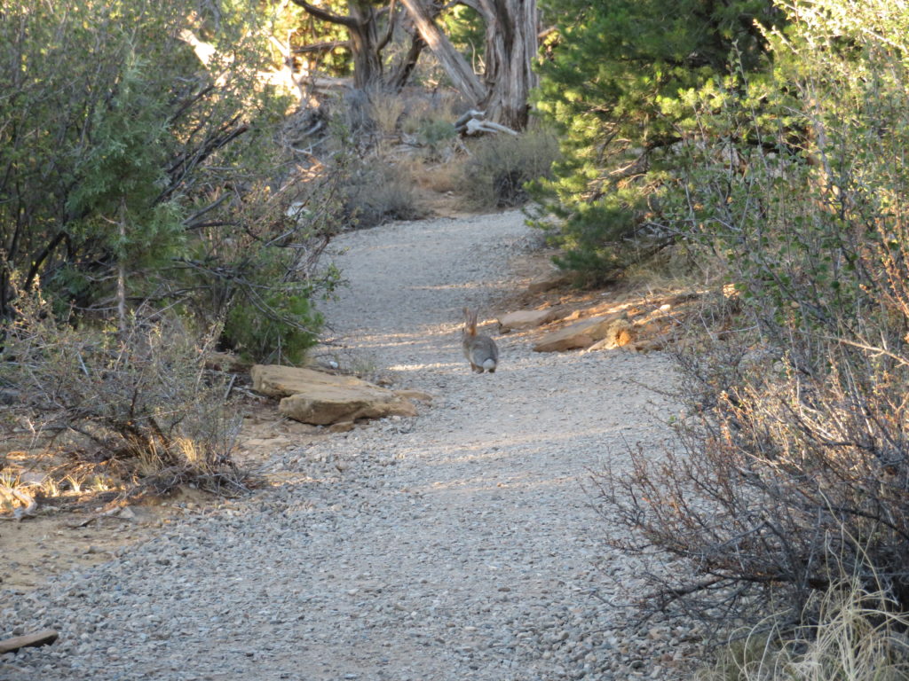
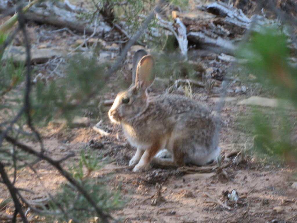
This state park is beautiful. There are two lakes and three ponds. Two ponds are for viewing nature and the third one fishing is permitted. Horseshoe Lake is a “No Wake” lake-perfect for all the hand powered water craft. Martin lake has a section that is “No Wake.” There are two campgrounds. One is called the Pinon Campground and the other is called the Yucca Campground. RV and campers, there is only electrical hook-ups. They do have a tent camping area which happens to be next to a 9 hole golf course! There are two trails to hike. The longer trail, Cuerno Verde, follows the outer shore of Martin Lake. The other trail, Hogback Trail, goes up the side of Hogback Ridge. Zoom Zoom and I took the Hogback Trail. It was easy to moderate. This trail takes you up to the highest pint in the park. The view was breathtaking. The only wildlife nature we saw was a cute cotton tail bunny.
Happy Face! Sore hips and thighs!
I think the rock resembles a “flat ass!”
Going up in elevation!
This island is in the middle of Horseshoe Lake. And…Zoom Zoom getting a great photo of my backside.
Isn’t this great! We love the hiking here. Zoom Zoom , don’t step off!


")


")
")


")


")


